tequila sunrise

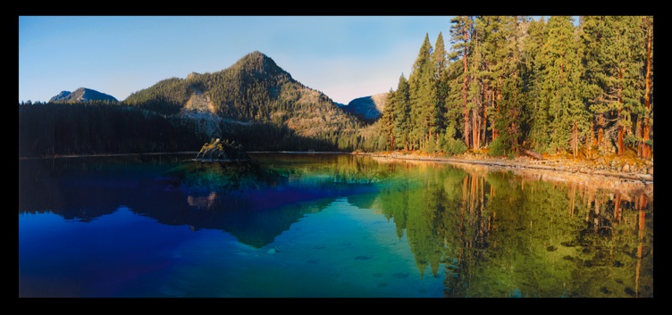


original sold
TEQUILA SUNRISE
60” X 25"

tequila sunrise
60” x 25”
tequila sunrise
During Pleistocene glaciations large ice caps covered the crest of the Sierra Nevada Mountains west of Lake Tahoe. The ice caps fed large outlet glaciers which flowed into the Tahoe basin through all of the major drainages along the west side of the lake. Over the last 1.3 million years, repeated glacial advances have progressively carved the granitic bedrock into the characteristic U-shaped glacial valley that forms Emerald Bay. The last glaciation in the Tahoe basin, known as the ‘Tioga’, peaked at 20,800 years ago. At that time the glacier that occupied Emerald Bay was one mile wide and 800 feet thick at a point just down-valley of Fannette Island. Fannette Island, near the head of Emerald Bay, is a glacially sculpted bedrock knob referred to as a ‘roche moutonnee’. At the Tioga maximum, Fannette Island would have been buried under 500 feet of dense, blue glacial ice. The Tioga-age glacier advanced and receded over ten times from ~21,000 years ago until deglaciation at ~14,000 years ago. The final glacial surge, just prior to 14,000 years ago, deposited a terminal moraine of glacial debris that enclosed the mouth of Emerald Bay. Had the terminal moraine not been breached by stream erosion the ‘bay’ would be isolated from Lake Tahoe similar to Cascade and Fallen Leaf lakes to the south. On the north side of Emerald Bay, about midway along the length, the high-resolution bathymetry reveals a large landslide deposit derived from a collapsed Tioga lateral moraine. The landslide was likely triggered by an earthquake along the range-front fault that traverses the base of Rubicon Peak north of Emerald Bay. The fault has subsequently ruptured, in a separate earthquake, evident from fault scarps that displace the landslide deposit. Hence, two earthquakes have occurred since ~14,000 years ago.
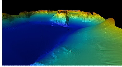
Sonar Imagery of Emerald Bay & Fannette Island
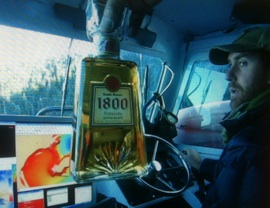
Brent mapping on a cold day in Emerald Bay
which sparked the inspiration for the title.