rubicon moon
journey around happy inc. 2008


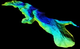
The high-resolution bathymetry of Rubicon Bay reveals a surprisingly different rock type than the granitic rock exposed above the water surface at the south end of the bay. On the subaqueous canyon walls (at the right side and center of the image) are well layered sedimentary rocks. The flat-lying sedimentary rocks were deposited in an ancestral Lake Tahoe that was beginning to form as early as 3 million years ago. The western edge of the ancestral lake coincides with the basin-bounding Rubicon Peak fault which traverses the base of Rubicon Peak and forms the 3000-foot-high range front just west of Rubicon Bay.
Inspection of the lacustrine sediments with a remotely operated submersible has further revealed annual cycles of alternating layers. Relatively thick, light-colored sand layers are interbedded with thinner dark-colored silt layers. The coarser sand layers correspond with the annual pulse sediment delivered to the ancestral lake during spring run-off. The thinner, darker layers represent the very fine-grained suspended silt and organic particles that slowly settled from the water column. These alternating light and dark layers from an annual cycle of sedimentation are referred to as ‘varves’.
As the Tahoe basin enlarged from continued normal faulting (both vertically and horizontally) a second
intra-basin normal fault formed. This fault, referred to as the West Tahoe fault, has down-dropped the eastern part
of the ancient basin (along with the sedimentary rocks) deep into the subsurface beneath Lake Tahoe. This fault also forms the 1000-foot-high submerged escarpment along the west side of Lake Tahoe immediately east of Rubicon Bay.
The surface elevation of Lake Tahoe has fluctuated dramatically over geologic time. These fluctuations are evident by the subaerial erosion of the deep canyons through the ancient sedimentary rocks in Rubicon Bay. Some of the rock layers exposed in the canyon walls are better consolidated and more resistant to erosion. These more resistant layers form small vertical ‘cliffs’ in the canyon walls while the less resistant layers form the lower angle slopes between the cliffs, similar to the Grand Canyon in Arizona. In places, along the narrow course of the canyon bottoms are large cliffs that at some previous time had spectacular waterfalls flowing over them.
rubicon moon
36” x 72”
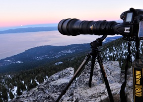
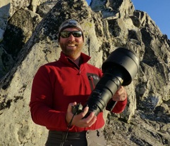
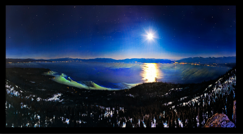
The envisioned angle for this Fine Art Sub-Scape was from the top of Rubicon Peak looking East over Rubicon Bay and Lake Tahoe. Searching through an almanac of Full Moons we found that the “Hunter’s” Full Moon would rise on October 28th, 2012, the perfect azimuth for our vision. The expedition was planned and the equipment prepared. Brent returned from Dubai on Sunday night and we set out Monday afternoon to summit Rubicon Peak; 2000 vertical climb in just under 4 miles, each carrying 40 pounds of photo gear. Weeks earlier a snow storm had dropped several feet of snow on the West shore but we had assumed that most of the snow melted, we were wrong! One mile into the hike we realized that we were unprepared but had no time to change plans, so we dug deep (literally & mentally) and summited Rubicon Peak 20 minutes before moonrise with just enough time to set up the photo equipment and change into warm clothes.
Brent Photographing the “Hunters” moon upon Rubicon Peak
Sonar Imagery of Rubicon & Meeks Bay